On January 25, 2013 some 50 spacetweeps gathered at NASA
Dryden in California's Mojave Desert, looking forward to a day of Science Adventures as guests invited with
social media accreditation. The hash tag for the event is #NASA_Airborne and this is the badge:
Spacetweeps setting up in the conference room
We were about to learn a lot about NASA’s Airborne Science
Program comprising almost 30 suborbital Earth Science instruments and 10 active
missions campaigns. Many of the aircraft are stationed at Dryden and as such
provide a fully functional and staffed “motor pool” for the science community.
NASA's Airborne Science Aircraft
Highlights from the day’s program:
Global Hawk
The Global Hawk is an autonomous, high-altitude science
aircraft. It has 32 hours of endurance, a range of 11,000 miles and a maximum
altitude of 65,000 feet. The plane can carry large payloads while monitoring
and measuring remote locations on Earth that are not easily accessible by
satellite and by piloted or remotely operated aircraft. (So, yes, you could argue that it’s pretty much
a sophisticated robotic spy plane that *will* find you on the Earth’s surface
if it’s really looking for you.) At NASA Dryden, however, the Global Hawk is
used for airborne science missions. The 44-foot-long aircraft is powered by a
single Rolls Royce engine and has an impressive wingspan of 116 feet.
Wing perspective
Photo credit: NASA Dryden
Group photo in front of Global Hawk
Uninhabited Aerial Vehicle Synthetic Aperture Radar (UAVSAR)
This reconfigurable radar system provides important data for
studying earthquakes, surface movements and other dynamically changing Earth
events, such as oil spills, landslides and glacier movements. The instrument is
designed to be operated on an uninhabited aerial vehicle (UAV) but is currently
being demonstrated on a piloted NASA C-20A aircraft. UAVSAR operates at 40,000
feet and will be conducting earthquake fault monitoring flights over Baja
California in upcoming weeks.
UVASAR instrument
Inside the C-20A
Spacetweeps at the C-20A
Surface, Water, Ocean, Topography (AirSWOT)
AirSWOT is an airborne instrument suite that will make the
first-ever global survey of Earth’s surface water, including phenomenology,
ocean and hydrology studies. The collected data can be used to produce
topographic maps of water surfaces and flood plains at centimeter-level
accuracy. AirSWOT will be hosted in a King Air B200 aircraft platform.
AirSWOT mission
King Air B200
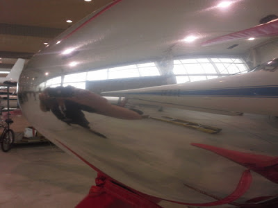
Reflective King Air photography
Additional information about NASA’s Airborne Science
Instruments and Missions is available here: http://airbornescience.jpl.nasa.gov/
Stratospheric Instrument for Infrared Astronomy (SOFIA)
SOFIA is the largest airborne observatory in the
world. It studies the universe at
infrared wavelengths, capable of making observations that are impossible for
even the largest and highest ground-based telescopes. The SOFIA observatory is
mounted inside a modified Boeing 747. I have always wanted to see SOFIA and I was not
disappointed. SOFIA looked majestic, even in the hangar, gleaming, looking brand-new
in the muted light, proudly displaying NASA’s collaboration with the German Aerospace
Center (DLR).
Another famous modified 747 is also at Dryden – One of the
two space shuttle carrier aircraft (SCA) used to ferry NASA’s orbiters around
the country. The SCA had been in service
for a long time, required major overhauls and has been permanently retired to
Dryden as a source of spare parts for SOFIA.
More about the science behind SOFIA: http://www.sofia.usra.edu/Sofia/science/sofia_sci.html
A podcast about SOFIA for German speakers: http://raumzeit-podcast.de/2011/06/03/rz016-sofia-infrarotteleskop/
Thank you, NASA Dryden staff for a wonderful day immersed in
Science!
So what do you really do at a NASA Social?
Tweet!
Here is a collection of all my tweets and tweeted pictures
from #NASA_Airborne in one place: http://eventifier.co/event/nasasocialdryden/ct_la


